This is another hike - a great hike, actually - that has been sitting in my drafts folder for too long. This turned out to be my last hike for 7 months, as a long-standing issue with osteo arthritis in my right hip finally got the better of me around this time, leading to surgery in September and an extended hike-less recovery period.
Some of the small details may have been forgotten, but the gist of it is worth recounting. A key aspect of this walk is that it is a circuit and for a dedicated solo walker, who also dislikes back tracking, a circuit route such as this is gold. This is more of a photo essay than a blog post, but there's a few factoids scattered throughout that you might find helpful if you're planning to do this route.
The route passes through stunning high country and arguably some of the best walking around. There aren't any gut busting climbs on the walk - like you get ascending Mt Feathertop and Mt Bogong - although the days are fairly long. The walk begins and ends at Bogong village (Note: Not Mt Bogong!), then follows a wide, anti-clockwise circle around the Falls Creek alpine resort.
 |
| Route map |
Day 1 - Bogong to Springs Saddle
It was a 4 hour drive from Melbourne. I drove down the hill through the village and parked beside a small reserve, at the start of the the Mt Arthur trail.
The initial route required crossing back over the river, via a bridge, then walking back up the steep streets of Bogong village, back to the main road, where I walked a few hundred metres south, to the start of Spring Saddle Track.
 |
| Bridge near Bogong Power Station |
 |
| Path through Bogong village |
 |
| Near Bogong village |
The lower section of Spring Saddle Track goes via a bloody great water facility. I wasn't sure of the access rules, but figured a discrete passing through wouldn't put any corporate noses out of joint.
 |
| The water facility on Spring Saddle Track. There is a way through here somewhere.. |
 |
| Reservoir on Spring Saddle Track. |
The track winds its way up the hills for quite a way and is a decent workout.
I'd planned to reach Bogong Jack's Hut for the night, but my right hip started giving me hell (osteo arthritis) and despite using pain killers, by the time I arrived at Springs Saddle at 5:30pm, 3 hours after I'd started, I had little interest in going any further that evening.
Day 2 - Springs Saddle to Pretty Valley Horse Yards
It got down to around -2C overnight and I woke to a clear, frosty morning. I headed off on the Fainter Fire Trail by 8:20am, arriving at Bogong Jack Saddle 1 1/2 hours later.
 |
| The Minaret at Springs Saddle. Morning of Day 2. |
 |
| A crispy road |
 |
| View of the Fainters |
 |
| Arriving at Bogong Jack Saddle |
 |
| Bogong Jack Saddle |
 |
| Gnarly tree at Bogong Jack Saddle |
 |
| At Bogong Jack Saddle |
 |
| View from Bogong Jack Saddle |
I was back on the trail by 10:15, arriving at Mt Fainter South by 12pm and Mt Jaithmathang by 3pm, stopping for 30 minutes at each. I was fortunate to have clear, blue skies and the walking was excellent.
 |
| Route out of Bogong Jack Saddle |
 |
| Approaching the Fainters |
 |
| On the flat ridge joining the Fainters |
 |
| Fainters...Mt Mackay in background (tbc) |
 |
| On the Fainters |
 |
| Hmmm That's Mt Mackay in the background I think. |
 |
| Interesting rock formation, don't you think? |
 |
| Mt Fainter South |
 |
| Mountain brook |
 |
Mt Jaithmathang
(Formerly known as Mt Niggerhead, it was sensibly renamed to better reflect the spirit of the original inhabitants) |
 |
| Tawonga Huts |
 |
| Tawonga Huts |
 |
| Tawonga Huts |
I was starting to feel a bit sore and tired by the time I left the Tawonga Huts and it was a bit of a grind walking the last few kms in fading light to Pretty Valley horse yards, where I arrived at 6pm, by which time it was dark. This was the location of a planned winter base camp for a friend of mine and it was good to see that all the gear that had been dropped earlier in the season was still in place and untouched.
 |
| On the approach to Pretty Valley |
 |
| On the approach to Pretty Valley |
Day 3 - Pretty Valley Horse Yards - Spion Kopje
'Twas a chilly night, verily! Apart from the synthetic quilt I wore two base thermal layers, a fleece jacket, a puffy vest, wind shirt, thermal bottoms, fleece beanie, woollen socks and base layer gloves. But I was still a little cold! I concluded that I really needed to finish the down quilt I'd been working on for a month or so. [Note: As at August 2014 it's finally finished! See the post elsewhere on the making of the down quilt.] I was on the trail by 8:20am.
 |
| Pretty Valley horse yards, where I camped for the second night |
 |
| Pretty Valley Horse Yards |
 |
| View south from the Horse Yards |
 |
| Heading away from the Horse Yards |
 |
| Heading south from the horse yards (looking south west) |
 |
| Cope Saddle Hut |
 |
| Route east of Cope Saddle Hut |
 |
| Cope Hut |
 |
| Cope Hut - inside |
 |
| A quick break near Marum Point. |
 |
| Looking west from near Marum Point, with Rocky Valley Storage in the distance |
 |
| Snow poles just north of Marum Point |
 |
| Turn off to Johnston Hut, Mt Nelse in the background |
 |
| Pretty sure that's Healthy Spur on the left and Baker Spur on the right |
 |
| Is this not beautiful? |
 |
| One of many tarns on the approach to Spion Kopje |
 |
| Hiker dude, hoping for gig in the next Montane catalog |
 |
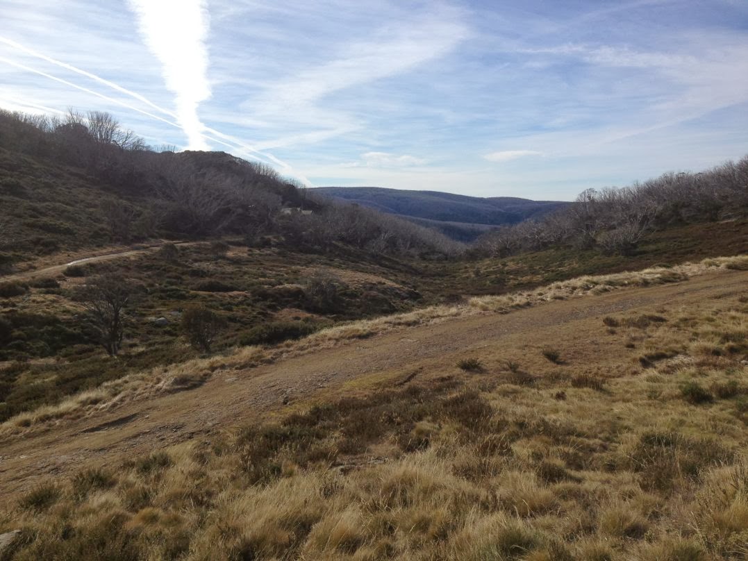
| Vapour trails above me. |
 |
| Spion Kopje Fire Track. |
 |
| Spion Kopje Fire Track with my only companion. |
 |
| Spion Kopje Fire Track. Stunning high country all around me. |
I arrived at the Spion Kopje summit at 5:15pm. I pitched the tent and tucked into dinner in the increasing cold. I was then treated to an amazing sky show.
 |
| Falls Creek, from Spion Kopje |
 |
| Sunset from Spion Kopje |
 |
| Sunset from Spion Kopje |
Day 4 - Spion Kopje - Bogong
It was another cold night, wearing all my items of clothes. It was also very windy and the Minaret got to have a decent wind test. I am pleased to say it passed! (No repeat of
my Mt Bogong disaster).
It was still very cold at dawn, but I got treated with a beautiful sunrise, to match the stunning sunset of the night before. My photos don't do either justice, but you'll get the idea. I am sure you will agree that to get the full splendor of it, you will just have to go and camp there yourself!
I headed off at 7:30am, arriving back at my car at Bogong village at 10:30am.
 |
| My camp at sunrise, Spion Kopje |
 |
| Glorious sunrise from Spion Kopje |
 |
| Morning clouds roll over the hills north of Spion Kopje |
 |
| Descending the Spion Kopje Fire Track (west) |
 |
Spion Kopje Fire Track (west).
This track descends down a steep, scrambly path. My route however, continued down the fire track |
 |
| Rocky Valley Creek |
 |
| Rocky Valley Creek. There's a shallow ford here. |
 |
| Les Stroud impersonation |
The key facts:
Walking time/distance - 23.5 hours / 63km
- Day 1 - Bogong to Springs Saddle - 3 hours / 7km
- Day 2 - Springs Saddle to Pretty Valley - 9.5 hours / 21kms
- Day 3 - Pretty Valley to Spion Kopje - 8 hours / 28.5kms
- Day 4 - Spion Kopje - Bogong - 3 hours / 9.5km
Water - I found a couple of small brooks along the Fainters-Jaithmathang section; elsewise, there were plenty of locations, for this time of year (early winter)
Navigation
Maps - SV Maps Bogong Alpine Area Outdoor Recreation Guide 1:50,000
GPS - iPhone 4S with Mud-maps app, incl 1:25k maps.
Comments:
For those not into 30km days, the walk could be spread over an extra day, with possible camps at Bogong Jack Saddle, Tawonga Huts, Johnston Hut (or perhaps Marum Point) and Spion Kopje. The walk could also be done in the reverse direction, with a stiff ascent of Spion Kopje on day 1.


Brings back great memories. Did this trip almost 20 years ago, but continuing on from Cope Hut to Ropers and Cleve Cole Hut and then a last day up Mt Bogong, then Little Mount Arthur and down to Bogong for a last day with 600m up, 1500m down. The ascent from Bogong was straight-forward, all the locked gates and fencing seems to be new.
ReplyDeleteIt is a nice part of the world and one I could visit agaian and again, no matter what the season is. I was surprised to see the Minaret, as I thought you normally used a Mid. Did yo use the Minaret because of the cold?
ReplyDeleteI like the second sunset picture on Day 3.
ReplyDeleteGday, Nielsen. I bought the Macpac for the more extreme conditions. This hike was it's first use. Loved it! The mid will be back this Spring. Cheers, A.
ReplyDeleteHi Ken. That would be a decent workout! Glad that my post was bringing back good memories.
ReplyDeleteIt was a beautiful sunset!
ReplyDeleteG/day Andrew, living in QLD i don't get to God's country country as much as i would like to and i'm not really a seasoned bush walker, so thanks for taking me on your journeys through your blog which i have just discovered, l can only dream of treks like yours ,thanks mate Matt Hollis
ReplyDeleteHi Matt. Thanks - I love feedback like that! While this blog is for the most part a personal diary for my own benefit, I have made it public in the hope that other people will find some inspiration to also get out into the wild places. My suggestion to you: Get yourself a book of short walks / day walks near your area and then try a few of them out. You never know where you might end up.....
ReplyDeleteBest regards, Andrew