- loved because of the stunning wilderness that is this area: the tranquil beauty of the river ... the jagged Crosscut Saw, with its terrific views, especially east to the Terrible Hollow ... Mt Speculation, with it's fun scrambles on the approach and equally outstanding views ... and the windy wildness of Mt Howitt.
- frustrating because in my two previous trips here - a solo walk in 2011 and a walk in 2013 with some family members - I failed to find the road that approaches Queen Spur and instead had to bash past thick scrub and fallen tress for a couple of hours.
This time I was determined to find the elusive road...
Unlike the previous trips I decided to get to the trail head on Friday night so that we could get an early start and all things being equal, reach Mt Speculation for the first night.
I drove up with frequent-hiker, Ali. 3 1/2 hours total, including 2.5 hours from Melbourne to Mansfield and 1.5 hours for the final 72km to the Upper Howqua campsite, via the Mt Stirling Road. We passed a large group of hunters and dogs at Howqua Gap. After a quick chat we were pleased to learn that the lads had no plans to shoot anything near our intended route. (Just as well - as we were heading into a National Park!)
The large camping area at Upper Howqua was mostly vacant, save for a couple of guys (Paul & Pat) having a weekend (and, I suspect, a break from their partners) for some 4WD R&R. Three more of the group (Trina, Peter & Sal) arrived around midnight.

It was a mild, still night and we woke to clear skies. We got away at 9am, rock-hopping across the Howqua River 5 times before heading up Queens Spur Road. There was plenty of scrub on the track in this section but it was easy to move through and the footpad was obvious.


Throughout the morning I'd been talking up to the group the difficulty of finding the road near Queens Spur and there was much anticipation in the group when we finally arrived at the spot where I'd lost the trail twice before.
So, it was with a fair amount of bemusement that when I looked up the hill to where the track should be (according to my GPS) I saw - not impassable bush - but a clear line of rocks marking what seemed to be a road, about 30 metres up the hill. "Surely not", I thought! I quickly scrambled up to the rocks and - surely yes - there was the road - overgrown, but no more than the track we'd been following. I have to say that I had pretty mixed emotions! I was happy to find the road - at last - but I could not (and still cannot) for the life of me figure out how the hell I could have missed this road before!!! To anyone reading this who held off doing this walk due to my earlier reports, my humble apologies!
We followed the road for about 30 minutes, arriving at Queen Spur at 12:50pm, where we stopped for lunch. It was a beautiful spot, marred only by the ants, which were everywhere.


After a short break to get our breath back (the approach to Mt Buggery is quite steep) we headed off, getting to Mt Speculation at 4pm, then continuing to the camp site another 10 minutes to the east.


Getting a selfie in front of this tree on Mt Spec is becoming a bit of a ritual.
We paid a visit to Camp Creek, 10 minutes away, where there was plenty of water flowing, filling up our containers. (Kudos to Trina for her very handy 6 litre nalgene!)

I got a fire going (note: A lightweight pruning saw is a handle tool to pack) and we spent a pleasant evening easting, toasting marshmellows and swapping stories. Trina impressed us with her dedication to food care, which included a lightweight foot bath.

The author relaxing after a day on the trail.
A forecast cool changes finally arrived late in the evening. It rained hard for most of the night, stopping suddenly at 7am, as we emerged from our tents.


We were on the trail by 8:45am, heading off into low cloud and cool temperatures. We walked back over Mt Speculation, arriving at Mt Buggery by 10:15am.

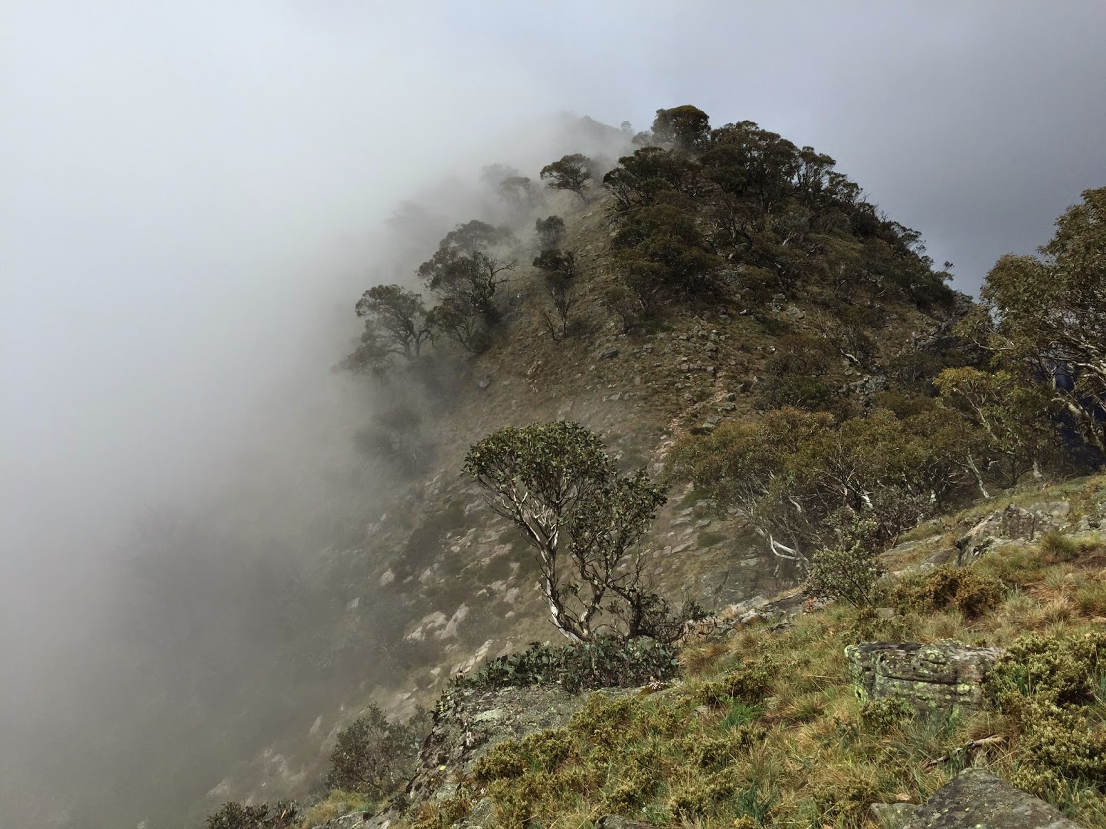
The Crosscut Saw was shrouded by low cloud, making for a eerie views and a more closed-in feel. Occasionally, the cloud would move off and the we'd get a look at the wild countryside around us.


When we arrived at the crossroads to Mt Howitt and the Vallejo Gantner hut a cold wind had come up and we dropped lower on the track to get some shelter for short lunch break.
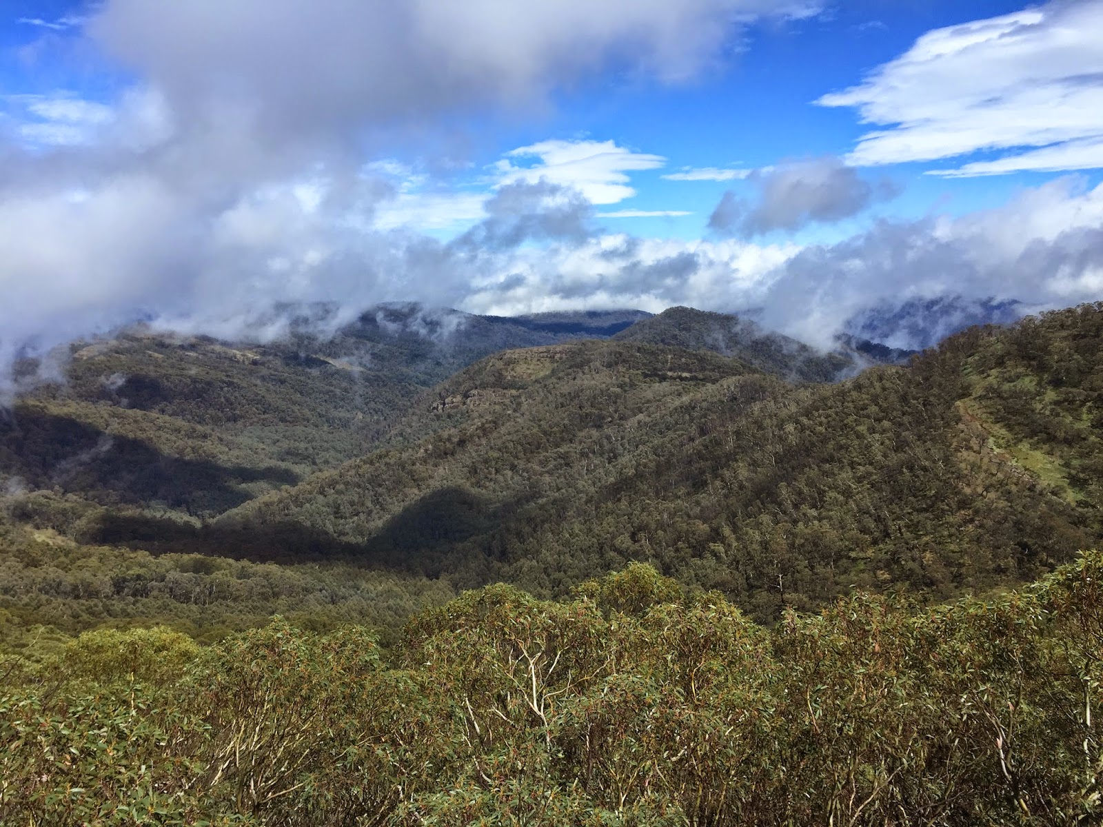
With the clouds removing any possibility of views we scooted over Mt Howitt to West Peak, where we chatted to a group of retirees, on their way to VG hut for the night, before heading down Howitt Spur for the long walk back to the Howqua River, arriving at 3:30pm.
At the river we met a couple of 20-strong groups of year 10 students, on the first leg of a week-long hike in the area. It was great to see kids being given such a terrific opportunity to experience bush walking and remote camping. One hopes that - for most of them anyway - this will be the beginning of a deep connection with the wilderness and an appreciation for the need for it to be protected.
We retraced our path alongside and through the river, arriving back at the cars at 4pm.
The key facts
Travel distances/times:
Drive to trail head - 4 hours + breaks
Total walking time/distance - 31km / 15.5hrs
- Day 1 - Upper Howqua campsite to Mt Speculation via Queens Spur - 15km / 7.5hrs
- Day 2 - Mt Speculation to Upper Howqua via Mt Howitt - 16km / 7hrs
Water:
- There was plenty of water at Camp Creek.
Maps:
- Printed map: Vicmap Howitt-Selwyn 1:50,000
- GPS - iPhone 4S with Mud-maps app, incl 1:25k maps: 8223-4-S (main one) and 8223-4-N (Mt Spec and north)
Comments:
- I can confirm that the road onto Queens Spur is definitely there!
Yes, Nielsen, the Crosscut looked awesome that day.
ReplyDelete