 |
| Mt Bogong, Victoria, Australia |
A tad under 2,000m (6,500ft), Mt Bogong is the highest mountain in the state of Victoria (Australia). Known simply as 'Big fella' to the indigenous people, it provides a decent physical challenge at any time and in the winter months when the area is blanketed in snow and the weather can be particularly unpredictable, it becomes a frozen alpine wilderness and a playground for snow shoers and cross country skiiers.
The last time I'd hiked for a number of days in winter was 25 years ago. At that time, I walked the famous Routeburn track in New Zealand with my brother, James. Those were pre-lightweight philosophy days for me - I wore a seriously heavy leather & wool flying jacket and calf-length army boots and had a canvas pack with a steel frame; we also carried potatoes! James, clearly ahead of his time, wore runners throughout the hike, as we trudged through bush, knee-deep snow and icy sludge covering a frozen lake (beat that, Roger Caffin!).
This time around I was keen to be a little more prepared and
planning for my first solo winter walk spanned several weeks. During this time I researched the area and acquired the additional gear I would need and went on smaller trips, to nearer locations, includinng Mt St Gwinear and Mt Stirling.
Day 1 - Mountain Creek to Mt Bogong via Staircase Spur (5 hours)
The day finally arrived. I was genuinely excited and it felt good. It's a decent drive to Mt Bogong from Melbourne - a good 4 1/2 hours - plenty of time to ponder the days ahead. The weather was sunny and clear. Actually, too nice for mine - I was worried I would get to the mountain top and find no snow (As it turned out, I needn't have worried.)
 |
| Bright |
 |
| The start of Staircase Spur |
I arrived at Mountain Creek Camping Area around 1:30pm. I parked the car a few hundred metres' up the four wheel drive track, then hoisted the pack onto my back, left an entry in the intentions book (not many recent entries - looked like I would have the mountain to myself) and walked briskly along the trail that followed a river for a kilometre to the start of the Staircase Spur. The altimeter was reading 650m - that left around 1,350m (4,500ft) to climb over the next 6 km.
 |
| Sign on Staircase Spur |
 |
| Lower section of the Staircase Sp |
 |
| West Peak from Staircase Spur |
The Staircase Spur is best known for being a relentless, uphill slog and I can confirm that this is the case and that it's particularly cruel for the first few hours of the adventure when your pack is at it's heaviest! Fortunately, the Staircase has a number of 'landings' where your quads and glutes can have a rest; also, your pain is somewhat offset by the stunning wilderness you are walking through and the increasingly frequent views of the Mt Bogong north face and the surrounding mountains as you climb further.
 |
Bivouac Hut
|
Bivouac Hut, at around 1,400m, provides a chance for a short rest while you take a few snapshots and from what I could gather, carve your initials into the hut. A sign on the door makes it clear that the hut is 'for refuge only', not for casual accommodation.
 |
| View of Eskdale Spur, from Staircase Spur |
It was getting dark as I moved above the treeline. It was beautiful, but I was starting to wonder about the camping conditions up top.
 |
| Sunset from Staircase Spur |
I rounded a couple of small hills then made my way up a narrow spur. As it grew dark, the wind through the snow poles was making a eerie sound. I passed a memorial cairn to three skiiers, who died at the spot in a blizzard in 1943.
 |
| Above the treeline and approaching the final climb to Mt Bogong |
The final part of the climb required walking up a steep, snow-covered slope. It was now night as I donned my snow shoes and crunched my way up the slope. I slipped on the steep slope a couple of times - a nerve-racking experience in the dim light - and I was sweating and breathing hard as I approached the summit.
It was something of a relief to finally spy the summit cairn of Mt Bogong (1,986m). I would have been ecstatic, but for the facts that I was tired, it was now dark, it was quite gusty on the summit and I had to find somewhere to pitch my tent.
I settled for a spot about 20m to the south (lee) side of the summit. The wind gusts were marginally less than on the summit itself.
I pitched the pyramid tent, adding the extra side tie outs (in addition to the four corners) and being careful to bang the snow pegs in deeply. I then climbed into my bag & bivy, made myself some dinner (kransky sausages) and a cup of tea, then settled down to try to sleep.
 |
| The tent was bulging heavily from the wind gusts |
Sleeping, however, proved to be problematic. While I was warm and comfortable enough, the wind stayed gusty all evening and into the night. At first the wind was just strong, but only annoying - the zipper on my tent door kept unwinding itself with the added tension. And it got worse, with the wind gusts growing stronger through the night. I would start to doze off, then a big gust would arrive, shaking the tent and making the sides bulge inwards (see pic).
Disaster
Around 3:30am, with the thermometer indicating -2C, there was a huge gust of wind which tore out the windward tie-outs, after which all hell broke loose, as the wind howled through the tent.
The tent has no floor and items started to get blown outside. Still half in my sleeping bag (mostly to stop it from blowing away) I frantically grabbed any items in reach and shoved them into the pack. Most concerning was the loss of one of my snow shoes!
With the small and important stuff secured I considered the tent itself. With a corner now flapping free the wind was wreaking havoc on the tent - it was only a matter of time before it was wrecked or blown away. I had no interest in spending a night on this mountain in the freezing winds, so I grabbed the free corner and sat on it, with my legs facing into the centre of the tent, straddling the centre pole. I then grabbed the bottom of either side of the tent wall either side of me and then pulled back, putting tension back into the tent. I found by doing this and leaning backwards, I was able to strengthen the tent against the buffetting of the wind. By twisting my hands in the silnylon tent wall I was able to shield my hands from the wind.
With this position established I found that the situation was somewhat stabilised. The only problem was that I could not move at all. Any time I let go one of my hands to do something, the wind would immediately whip through the tent like crazy. In a series of short, sharp moves, I was able to put on my snow jacket and boots and later some rubber gloves. I reached for my over pants, but the wind caught them and I watched in dismay as they were whipped to the far side of the tent, where they rested briefly before being blown away.
I considered whether I should use my new Spot 2 beacon to alert S&R. However, with the strong winds a helicopter was out of the question so it would have taken hours for rescue to make the journey up the mountain. I concluded that I was going to have to deal with the situation myself.
So there I sat in the dark, riding my tent in the wind like a yachtsman rides a catamaran. With most of my clothes on and by sitting on my bedding I managed to keep warm enough, but I wasn't game to move until I could see clearly.
I would like to tell you about the profound insights that came to me during this time - about some defining moment of existential awareness perhaps or some life-altering epiphany - but to be honest, I found myself just focussing on the moment - wondering about my grip, about items I could recover next , about when the next big gust would come and what I would do if I lost the fight with the wind and the tent was blown away. What I can say though is that I certainly felt 'alive' and I reckon the adrenalin was pumping.
Day 2 - Mt Bogong to Mt Arthur via West Peak and Quartz Ridge (10 hours)
 |
| The Mt Bogong summit cairn and my temporary refuge from the wind |
Daylight started to arrive around 6am and by 6:30am it was light enough to make a move. During the the 3 hour wait in the night I had hoped that daylight might bring a cessation in the wind; but no such luck - it just kept on blowing. With a pleasant decamp not an immediate option, I elected to pack up the remaining gear (bedding mostly) and the tent as fast as humanly possible and then move all the stuff to the somewhat sheltered, lee side of the summit cairn.
 |
| Man, that wind was cold! |
It was freakin' cold! It only took me 3 minutes to pack up the tent and dig out the pegs, but by that time I was shivering heavily and I was not a happy camper. On a more positive note, once I had warmed up a bit I checked around the tent site and found a few items, including my missing snow shoe. Excellent! (Without both snow shoes I would have aborted the trip, given the amount of snow up top).
I did a quick inventory and discovered that I was missing my titanium pot and pot cosy, my spork, my mug (a takeaway coffee cup) and the overpants. I concluded that all things being equal I had got off lightly given the circumstances.
The other notable discovery for the morning was that the hose on my Platypus bladder had frozen solid as had the bladder cap. As I didn't feel much like a sit down session melting snow to drink, I elected to stay thirsty for the morning.
The summit of Bogong early on an winter morning may be an unfriendly place, but it can also provide some spectacular views. I shook some blood into my hands and took a few photos of the scene.
 |
| View SE from Mt Bogong summit, towards where I camped |
 |
| View west |
 |
| View north |
 |
| View east |
 |
| Starting to warm up again |
Photos taken (quickly) and now a lot more insulated, I began the day's walk, heading west along the summit plateau. The views were stunning.
It stayed cold and windy all morning. When taking the photo below I removed my overmitts, only to accidentally drop one of them and have the bloody wind snatch it away, leading me into a comic scene where I am chasing a mitt at full tilt in my snow shoes, with pack on, across a slope where the drop off was becoming increasingly steep. Each time I got close enough be bend down to pick it up, the wind would whip it away again. I even tried the classic hero dive, only to miss by inches as I slid face first across the slippery snow. I was finally able to catch it before the slope got too steep. Phew! For the record, wind is
not my favourite of the four elements.
 |
| On the move to West Peak (looking back at Mt Bogong) |
I continued on to West Peak, where there were great views of Bright and the surrounding area.
 |
| West from West Peak |
 |
| Town of Mt Beauty from West Peak |
 |
| Mt Bogong, from West Peak |
From West Peak I headed south east to Quartz Knob and the start of Quartz Ridge
 |
| Southern end of West Peak, from Quartz Knob |
Quartz Ridge had partial snow cover and I found it easier without the snow shoes for much of the way down.
 |
| Quartz Ridge |
 |
| I was knackered and needed a quick snooze in the now warm sun |
The wind died down as I descended the ridge and as I neared the lower end it was getting relatively warm. The water in my Platypus had finally melted so I could drink.
I stopped for a feed of salami, cheese and bread. Now well fed & warm, the all nighter started to catch up on me and I settled in for a track-side kip for half an hour.
Quartz Ridge ends is a narrow gully. I refilled the bottles in (not-so) Big River.
 |
| Creek at the start of the Quartz Ridge track |
I made my way over to the Bogong Creek Saddle camping area, then headed up the steep track that leads up Mt Arthur. My energy levels started to fade quickly as I climbed, so while I had originally planned to continue walking later into the evening, I decided to spend the night on Mt Arthur. Decision made, I found a nice sheltered spot to pitch the tent - after the excitement of the previous night I was keen to avoid exposed, wind-swept locations!
 |
| A nice camping spot on Mt Arthur |
When I inspected the tent corner that had torn on the previous night I found that the tie out had been torn cleanly off the corner material - the tie out and the corner material were both intact ie. it was the stitching that failed, not the ripstop nylon (silnylon) nor the grosgrain ribbon. I found that somewhat reassuring - the materials are fundamentally sound - I just need to get better at sewing!
I rigged a temporary tie out by wrapping the corner around a small piece of wood.
 |
| A temporary fix to the tie-out that got ripped out on Mt Bogong |
Enjoyed a stunning sunset, then a yummy dinner of Chirizo sausages during dinner. I was dismayed that my gas canister, which I was using with my MSR Pocket Rocket, should have lasted for at least another couple of nights, stopped working after about 5 minutes of burning. I shook it and found that there was still plenty of fuel inside. I had brought a spare cannister, so was able to continue cooking, but it was a mystery for me.
Anyway, I was pretty tired after all the excitement the previous night, so I turned in early and was asleep quickly.
[I looked into this issue after I returned home and found out that this is a known problem for butane/propane mix gas stoves when used in the snow. The butane component of the mix has a boiling point (when it turns to vapor) of -0.5C, whereas, the propane has a much lower (-42C) vapor point. The Pocket Rocket stove, which sits on top of the gas cannister, depends on the fuel being in gas form so the it will rise up to the burner; however, in conditions below -0.5C (such as I was in), the butane stays in liquid form and sits at the bottom of the cannister, while the propane component, which is still a gas (unless you happen to be in the Alaska or perhaps Camp 3 on Mt Everest) burns off. ie. once the propone has burned off you are left with a can of butane.
To address the issues you can use techniques to keep the cannister warm (eg base plate on which to cook, cosy for the can) or just get a stove that is designed for use the snow, including features such as the ability to rest the cannister upside down. (Hmm, I like the idea of a new bit of gear..) If you want to know more about this area, have a look at the section on stoves in the Bushwalking FAQ maintained by Roger Caffin. ]
 |
| Sunset on Mt Arthur |
Day 3 - Mt Arthur to Mt Nelse via the Grey Hills and Spion Kopje (9 hours)
It got down to -4C overnight and it was still around -3C when I woke up to the frosty new day.
 |
| Frosty morning on Mt Arthur |
As with the previous morning I found my Platypus bladder had frozen up. After the gas bottle issue the night before I didn't want to use up gas melting snow for my cereal mix, so after a quick breakfast of muesli bars, I packed up and headed south along the Grey Hills.
 |
| The Grey Hills |
From the freezing start, the day quickly warmed up and by 8:30 the temperature had risen to around 12C. I had put on most of my winter gear at the start of the day so was starting to cook in the unexpected heat. I stopped to shed most of my gear and to give the tent a chance to dry out.
 |
| After a 15C rise in temperature since dawn I needed to shed most of my gear |
I continued on along the Grey Hills, enjoying terrific views in all directions.
Snow gum faeiries
I had an odd experience while passing through the snow gums on the Grey Hills. At one point I heard some voices off in the distance. It sounded like a group of people chatting. I stopped and looked back up the ridge, expecting to see some other backpackers appear. When no-one showed after a minute or so, I continued on, only to hear the voices again. Once again I stopped and waited and once again no-one appeared. I decided I must be hearing the sound of wind through the snow gums or perhaps the sound of their branches rubbing against one another.
Shortly after I heard the voices again, then tripped badly on sticks on the path. The same thing happened again 5 minutes later. Now, while my rational side told me that I was just tired and clumsy another voice told me otherwise - that there was something strange going on with these snow gums and was now feeling just a little spooked.
I decided to leave nothing to chance and spoke aloud, saying "Guys, I'm not sure if you're annoyed with my being here or if you're just having some fun; but either way I am quite tired and I would appreciate it if you would stop tripping me up." Silly of me, I suppose, but it is worth noting that though I did continue to hear the 'voices' from time to time, I didn't trip on any more sticks on that ridge.
 |
| Looking northward at the Grey Hills |
 |
| View from Crows Nest of the steep trail leading to the Spion Kopje Fire Track |
 |
| Crows Nest, with Timms Spur behind and Mt Bogong in the background |
 |
| The Grey Hills and Mt Bogong (rear) |
 |
| The route to Spion Kopje |
 |
| East view while heading to Spion Kopje |
 |
| Spion Kopje |
 |
| Spion Kopje |
 |
| Falls Creek and Rocky Valley Storage, from Spion Kopje |
 |
| Falls Creek Village |
 |
| Timms Spur and Mt Bogong |
 |
| Spion Kopje Spur |
The walk along the Spion Kopje Fire Track was fairly easy-going and the clear skies made for great views.
 |
| Spring melt in progress |
 |
| Now that's clean, clear water |
 |
| XC ski tracks on the Spion Kopje Fire Track |
 |
| (Above and below) The nameless hump that stands 1893m near the eastern end of the Spion Kopje fire track |
 |
| Snow poles at Warby Corner near Mt Nelse North |
It was late afternoon by the time I arrived at Warby Corner, where the Spion Kopje Fire Track meets the Big River Fire Track. I made my way southwards, stopping briefly on Mt Nelse North and Mt Nelse.
 |
| Facing northwest near Mt Nelse |
 |
| Big country near Mt Nelse |
 |
| Mt Nelse |
 |
| Johnson Hut access road. Mt Nelse in the background |
About 3 km south of Warby Cnr, I came to the turn-offs to Johnson's Hut and Edmondson's Hut. I threw a mental coin and decided on Johnson's for the night. I followed the track for a kilometre as it descended down a hill to the hut.
It was a nice looking hut, but it turned out that it is managed by a ski club, who have divided the hut into two sections - a large front section used exclusively by the club and a small rear section that is available for use by the public (like me). I reckon that rear section would be great for a single person, or perhaps a couple. As it turned out there were a couple of older fellas already in residence - Graeme & Bill. It made for a cosy night as I shared the floor with Bill, with my main concern being avoiding being trod on by club members slipping past for late night nature calls. A note on Grame & Bill. They're both 70-odd, have been mates for 30 years and after a long hiatus, were rekindling a passion for XC skiing. In fact, they were at the end of a 10 day ski tour throughout the area. I hope to be just as keen to have a go when I get to that age. Onya, guys!
 |
| Graeme & Bill in Johnson Hut |
Day 4 - Mt Nelse to Cleve Cole Hut, via Roper Hut, Duane Spur and T Spur (9 hours)
I had a long day with some hard walking ahead of me, so, after my now preferred breakfast of hot muesli cereal.and good wishes to my Bill & Graeme, I set off early the next morning. I walked back up the hill, skirted around Mt Nelse then headed north back to Warby Cnr, then beyond. The cloud cover was low and there was a sleetly wind blowing. In the reduced visibility I found I was using the snow poles to navigate.
 |
| The weather closed in a bit in the morning |
Annoying songs
It's an interesting thing walking in low visibility conditions, with your gear wrapped around you and your goggles on. Your sensory inputs get somewhat muted and your personal space compresses in. As I navigated along from one snow pole to the next I found my attention was drawn to my breathing and to the steady, rhythmic crunching of the snow with each step of the snow shoes. Crunch..crunch..crunch..crunch.
It's times like these you often get a song coming into your head - usually some annoying song, like The Proclaimer's "500 Miles" (come on, admit it, you're singing it now) or perhaps Rebecca Black's "It's Friday" (if you haven't had the pleasure, look her up on YouTube). This day it was the Carpenters' "Top of the World" which came to haunt me. Sure, it was a hit single in it's time and the lyrics were somewhat appropriate for my situation - but it just wouldn't go away!
Like getting rid of hiccups, to get rid of a unwanted song in your head you have to distract yourself. For this purpose I brought out my never-fail solution. Now it may be that a children's song about plucking skylark feathers is considered annoying if you happen to be French, but to me "Alouette" saved the day! Here are the lyrics so you can sing along with me:
 |
| Cold, sleety day with a crap song in my head |
Alouette, gentille AlouetteAlouette, je te plumeraiJe te plumerai le bec(Je te plumerai le bec)Et le bec(Et le bec)Et la tête!(Et la tête!)Alouette!(Alouette!)O-o-o-oh[repeat as required]
 |
Roper Hut
|
I arrived at Roper Hut around 11am. The hut was only recently rebuilt. It is a great hut, surprisingly well provisioned and would be a top place to park for the night.

I still had the bulk of the day's walking in front of me, so after a short break for salami and cheese, and to fill my water bottle from the snow melt off the hut roof, I was back on the trail again, heading to Duane's Spur
 |
| Misty view as I left Roper Hut |
 |
| Mist over Duane Spur |
Duane Spur mostly involves walking well-marked trails through bush. It made for a pleasant change to the snow shoe slog from the morning. There were a number of spots where trees had fallen across the track, providing opportunities for tree-limbo, branch-hopping and (my personal favourite) the under tree monkey hang.
 |
| One of a number of fallen trees across the track. Time for a chainsaw visit from the Parks lads! |
 |
| Old man of the forest |
After Duane's Spur the trail dropped steeply to Big River.
 |
| First sight of Big River |
While its name is probably a bit grandiose, Big River nevertheless has enough flow to make crossing it a little tricky, particularly after heavy rain or during the spring melt. To reduce water crossing mishaps Parks have strung a chain across the river. After a short internal debate, I elected to keep my boots on for the crossing, which proved to be fairly straightforward in the thigh-deep water.
 |
| The crossing chain at Big River |
The river crossing done, I ground my way up the steep incline of T Spur, with plenty of stops to get my breath back and my heart rate down. It was quite a work-out!
T Spur ends at T Knob, from which there is a moderate climb towards the eastern flank of Mt Bogong.
 |
| View south from T Spur Knob |
 |
| Walking up from T Knob |
 |
| There's something reassuring about a beer can being used as a trail marker. |
 |
| The more standard Alpine Walking Track trail marker |
 |
| Creek where the trail separates and the AAWT veers off to the east. |
 |
| Valley on the approach to Mt Bogong |
 |
| Geoff relaxing at Cleve Cole Hut |
I arrived at Cleve Cole Hut in early evening. It's a big, sturdy hut with a heap of mod-cons, including large living area, with wood stove, kitchen sink, running water, stove and enough bunks for 12-15 people. It has DC power, providing electric lighting. All in all, a very nice place to spend a night. I shared the hut with Geoff and Melinda, a terrific couple from Mallacoota who were mid way through a 2 week stay at the hut. As Bogong club members they get to use the hut whenever they like and to have access to a rear storage area, where they can keep a large container of suppliers (which they carry in in the autumn). So while I polished off the remaining scotch in my hip flask, they enjoyed a couple of cocktails from their supplies. Made for a pleasant evening. Such a life!
 |
Rear bunkroom
|
Found things
Another curious thing: when I told Geoff and Melinda about my adventure on Mt Bogong a few days area, they gave a little look of surprise then said "Oh, are these familiar?" and proceeded to bring out my pot and spork! It turns out that Melissa had found the spork near where I'd camped and Geoff had found the pot at the base of the southern face of Mt Bogong, where they'd been blown to that Friday morning! Geoff said that he also found a coffee cup a metre away from the pot! Amazing stuff. Sadly, they did not spy my overpants, which presumably, were taken on another route by the fickle winds that night.
Day 5 - Cleve Cole Hut to Mountain Creek via Eskdale Spur (4 hours)
It was a crisp, clear morning as I headed off from Cleve Cole hut aound 7:30am.
 |
| Cleve Cole Hut |
It was a 2 hour snow shoe walk to the start of Eskdale Spur. The beautiful conditions made for a ton of photo opportunities
 |
| Heading out from Cleve Cole Hut |
 |
| The southern slope of Mt Bogong (summit cairn just in view), where some of my gear went flying |
For the descent from Mt Bogong I used Eskdale Spur. This involves a shorter stage on the spur than for Staircase Spur, but a longer river-side walk once down.
 |
| Top of Eskdale Spur |
There was some decent snow cover at the top of the spur so I made my way carefully until below the snow line.
 |
| Eskdale Spur |
It was about this point that my camera battery gave out, so there are no more photos after this.
Blisters
With the adventure now almost over, I started getting impatient to get to the end. In what will go down as one of my more foolish decisions, I decided to jog down the mountain to speed up proceedings. All went well for the first 40 minutes or so, but at about that point I started noticing that my toes were getting sore. And they got sorer...and sorer. I carried on, figuring I would sort them out once I got to the river. When I eventually got to the river, about half an hour later, my toes were giving me a lot of grief. I took off my boots and socks and found I had massive blisters on both feet. I stuck on some bandaids, then put my socks and boots back on. However, after walking through the creek a few minutes later, my feet were sliding around painfully in my now-soggy boots. I tried walking in my boots without socks, but that was worse. I then tried walking barefoot on the track, but that was a bit too raw for my feet. I then tried walking in my socks, with my boots tied together by the laces and hanging over my shoulder. This I found worked, though I could only walk slowly. So in this fashion, with my figurative tail between my legs, I hobbled the last 4km to the car.
With some relief, I updated my entry in the intentions book, threw my gear into the car and headed off for the long drive back to Melbourne. Looking back it had been an eventful and amazing 5 days, with plenty of moments and memories to savour. I also got to give my gear a good workout - I will do a review of the gear in a separate post.
Edit: Navigational tools used for this trip:
- For planning the walk I used the book “Bushwalks in the Victorian Alps”, by Glenn van der Knijff. I took photocopies of the relevant pages on the trip also. You can get the book from www.osp.com.au.
- For a physical map I used the 1:50,000 SV Map, “Bogong Alpine Area”. See www.svmaps.com.au.
- I used my iPhone as GPS. My mapping app was Motion-X, which has reasonable, though not great topo maps, which are accessed on the fly ie. like Google maps. I couldn’t use my preferred mapping app, Mud-Maps, as due to a wireless error on my iPhone, I was unable to download the relevant 1:25,000 topo maps before the hike.
- For this particular walk I found route finding to be fairly straightforward as the trail was generally along ridge tops and/or between fairly obvious waypoints. That said, I referred to the physical map regularly and I used my GPS from time to time. I also got to enjoy fine weather for a lot of the trip, so didn’t have to deal with low visibility very often.
- Assuming you have a good map and a compass, taking a GPS is optional, but very convenient. If you have an iPhone or other smart phone with a GPS, that will also be sufficient for the region.
- I also took a Spot 2 beacon on the trip. Not a critical item, I feel, but it gave my family some comfort as I headed off into the alpine snow on my own.
Thanks for visiting my blog. If you enjoyed the report, have a story of your own or perhaps have a question, feel free to leave a comment.
Andrew
 For my return to bushwalking after a 9 month break (due to a dodgy hip), I chose to return to Mt Clear. This time I was going to attempt walk #19 from the book Bushwalks in the Victorian Alps. This walk starts out in the more remote areas out the back of the Mt Buller and Mt Stirling ski resorts in Victoria. The full walk is a 41 km circuit that takes you via Mt Clear, King Billies (1 & 2) and the Bluff. It is not the most frequented of walks in the warmer months, so I figured in Winter I would pretty much have the area to myself for a few days (which I almost did - more on that later)


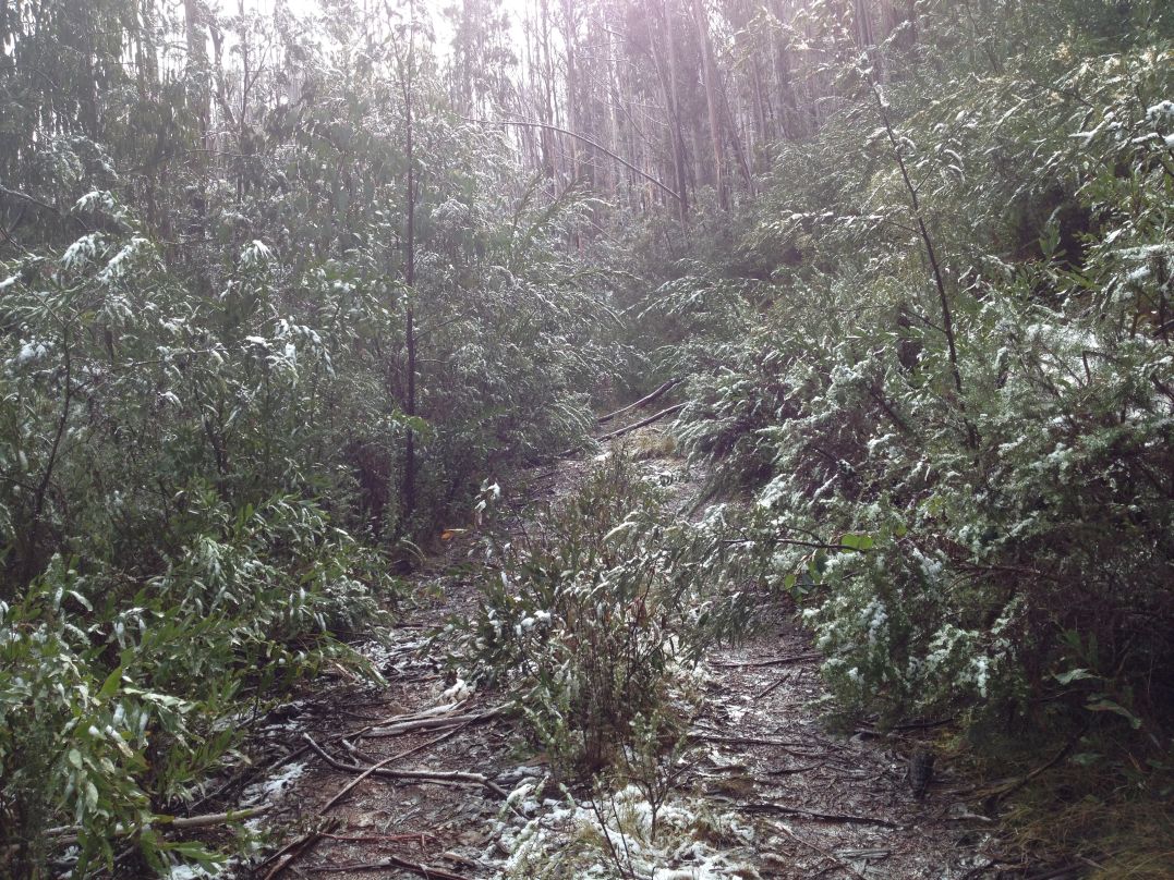


 It was an eventful journey down the 24 kms of Brocks Road. The first section was covered in deep snow, which gradually thinned out as I descended into the valley.
 Later as I continued to descend the road, with the snow thinning and the light fading I spotted what looked for all the world like a human footprint in the road. It was bizarre and I wondered what sort of wild man-beast would be walking around in this freezing place without shoes. It was easily rationalised as simply another odd shape, randomly formed by melting snow - but that didn't stop me looking over my shoulder a few times.
 As night fell I pitched the tent on the side of the road where there was still a thin layer of snow. After a dinner, I read for a while before nodding off to a decent sleep.


