Thursday, January 30, 2014

Steavensons Falls and Kepple Lookout circuit, Marysville - Jan 2014


Marysville is only a hour's drive from Melbourne - and a pleasant hour too, for the most part, especially the section of the Black Spur - a winding, hilly road, through a fabulous forest of tall mountain ash trees.

This walk loops past Steavensons Falls and the Kepple Lookout, for a decent 12km jaunt.  After parking at the information centre, I headed off.   The trail starts through some public parkland, before joining the Tree Fern Gully Track.


Pond, Marysville

Steavenson River

Tree Fern Gully Tk

Massive ferns in the Tree Fern Gully Tk

Log jam in the Steavenson River, near Marysville


Steavenson Falls

Steavenson Falls

Steavenson Falls from top-of-falls lookout

After the falls, where the trail is less frequented, it becomes a bit 'rougher', but still straightforward to follow. The climb first to the falls lookout, then to the ridgetop is quite steep and is a good workout.  From there the trail is fairly easy through to the Kepple Lookout.
Sugarloaf Peak and the Cathedral  in the distance at centre

Marysville in the foreground left; the Cathedral and Sugarloaf Peak at centre rear


Bush on Keppel Tk
Did you know? Unlike other, more tough-skinned Eucalypts, Mountain Ash trees are 'thin-skinned' and can be destroyed or badly damaged by bushfire. However, this very cool tree has answer to the regular bush fires in Australia. An adult Mountain Ash tree spreads a bed of seeds all around it. These lie dormant until a bushfire and they are 'cooked' by the ashes, making them spring into life. So, after a bush fire, around the burnt mountain ash trees you will find a gazillion little saplings, shooting up as fast as they can - they've got 20 years until they're adults. So though a tree may die, there's another generation ready to replace it and continue the species.


Kepple Lookout. Marysville, the Cathedral and Sugarloaf Peak in view

After the lookout, the trail drops steeply down to the valley, passing through stunning bush on the way.    Approaching Marysville it was great to see all the new houses that are have been built.  It's a beautiful area and it is a good that people are still choosing to live here, despite the hardship brought on by the 2009 bush fire.

Wild flowers near Marysville

New houses in Marysville, built since the 2009 bushfires that wiped out the town
The key facts:

Distance: 12 km
Time: 3 hours
References: 
  -  "Daywalks Around Melbourne" Glenn Tempest. Walk #62. Avail. from Open Spaces Publishing;
Navigation: The trail is well maintained and with good signage
Challenge level:  Those with moderate fitness should knock this over in 3-3.5 hours. If you're a slow walker or you are taking younger children, you should allow 4-4.5 hours.
Phone reception: Good reception on most of the trail.
Water: Carry what you need.

Monday, January 27, 2014

Mason Falls Circuit, Kinglake National Park, Victoria, Australia - Daywalk

Hello dear walking enthusiast. As mentioned in the last post I am still training up my fancy new hip joint by doing a bunch of shorter walks.  I enjoyed last week's visit to Kinglake National Park so much that I did another one today.  This time it was the Masons Falls Circuit.  

The walk starts at the car park at Mt Sugarloaf, about 10 mins drive out of Kinglake township. (Note: Readers should not confuse Mt Sugarloaf with Sugarloaf Reservoir, which is at Christmas Hills, about 20 kms OR with Sugarloaf Peak, which is part of the Cathedral Range, where I visited last year.).

As always the roads in the area were busy with cyclists, panting up the frequent steep hills, as well as a few chunkier gents on their hogs and even some hoons, getting irate at another car, that was taking their precious time in passing a cluster of riders.

 It was forecast to get to 35C today so I hoped an early-ish start would mean avoiding the worst of the heat. When I got started on the trail at 9am it was in the low 20s, with a cool wind blowing.  Very nice.

For those referring to the guidebook (see below) I did the trail in the anti-clockwise direction, which is the reverse to that described.  My reasoning was that the reverse direction would mean having to walk up rather than down the steepest section - I am trying to get fitter, after all!

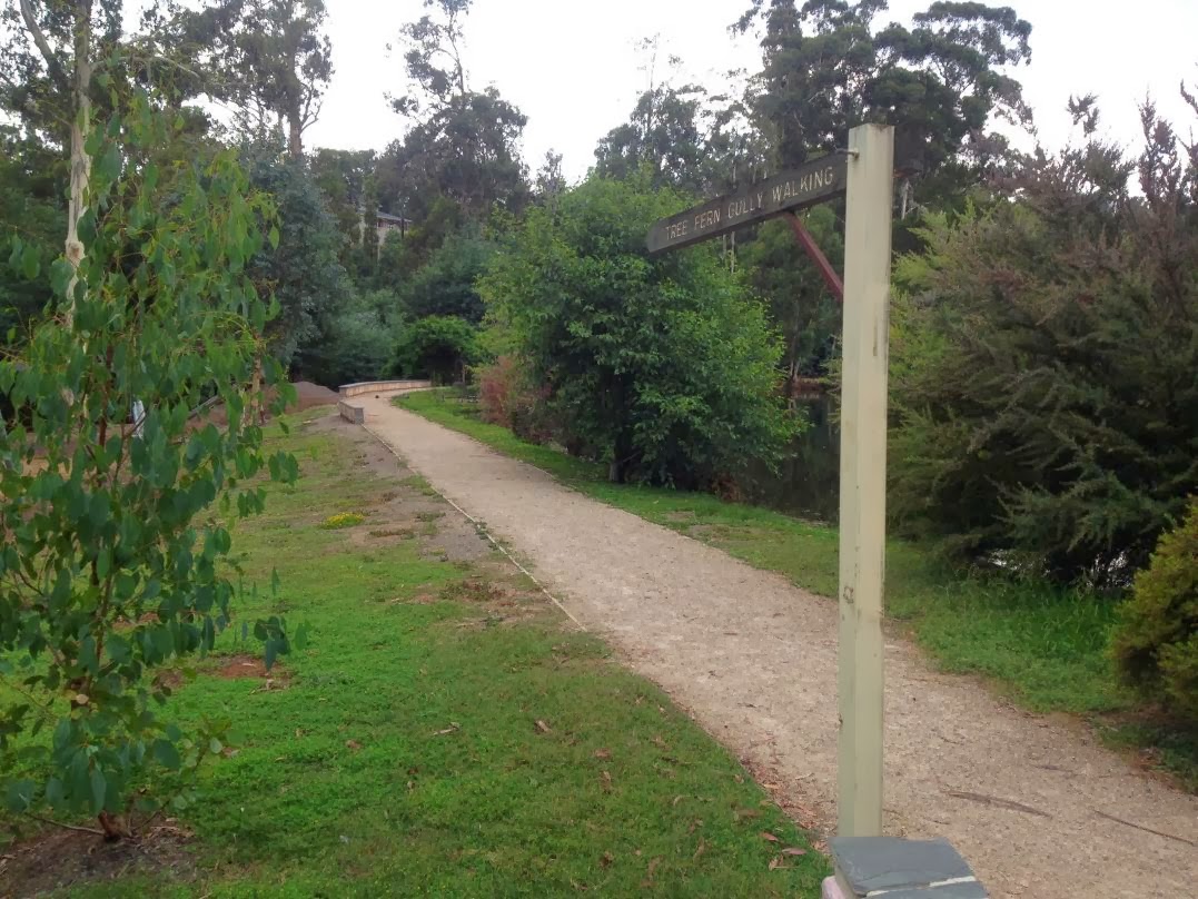
The trail was very clean and clear throughout, making for easy "zone-out" walking.  It follows a ridgeline on a gentle decline for a couple of ks.  Despite the great potential for views, there wasn't much on offer due to the thick bush around the track.  Still, if you like being in native bush, it was very pleasant.


The ridgeline walk finishes at nice little picnic ground near the Parks Office, then follows a gravel road for 2kms to the Masons Falls Picnic Area.  I surprised a black wallaby on the way.  There were also some tiny birds - fantails, I think - and lots of Monarch butterflies.


Mason Falls Picnic Area

Mason Falls, Kinglake National Park

From Mason Falls the trail is the Running Creek 4WD track. It drops down to Running Creek, then sidles alongside the creek for about 4 kms, before rising steeply to join the ridgeline about 1km below Sugarloaf Peak.

Running Creek Track

Running Creek Track


Running Creek Track, near Hazel Glade.
The day was getting pretty hot by the time I got to the steep section.  Between the heat and the now-swarming flies the walk lost some of its thrill and I was happy enough to be back to the car, a tad after midday.

My new hip troubled me a bit on the flatter sections, but seemed ok on the climbs. I guess it'll be a while before it's close to 100%.  One thing I noticed is that my foot is turned in slightly.  Not a major problem, I guess, but I just have to make sure I don't walk in circles!

When my groovy new Barmah hat arrives at Ray's Outdoors
 in the city, I'll stop wearing silly hats
The key facts:

Distance: 12.5 km
Time: 3 hours
References: 
  -  "Daywalks Around Melbourne" Glenn Tempest. Walk #56. Avail. from Open Spaces Publishing;
  -   Parks Victoria page for Kinglake National Park.
Navigation: The trail is well maintained and with good signage
Challenge level:  Those with moderate fitness should knock this over in 3-3.5 hours. If you're a slow walker or you are taking younger children, you should allow 4-4.5 hours.
Phone reception: Good reception on most of the trail.
Water: Carry what you need.  There are taps in the toilet blocks at Mason Falls Picnic Area, but there are signs advising against drinking it.  There is access to Running Creek, but I would expect you should treat it before drinking it.

Sunday, January 26, 2014

Andrew Hill, Kinglake National Park - Jan 2014 (Day-hike)

It's been over 3 months since I had hip surgery.  I will blog about the details of that separately.  For now, I just want to say that the core recovery from a hip replacement is very quick - you can be walking around normally within 4-5 weeks.  Full recovery takes a few months and a common trap for folks with newly replaced hips is to go too hard, too soon.  Bad shit can happen, like getting a cracked femur.  (ugh).  So, despite the fact that I reeeeeeally miss getting out into the Victorian alps, I've had to bide my time, while the full healing occurs.

Apart from the usual bunch of exercises from the Physio [Side note: Physios must surely be the most frustrated healthcare professionals.  I mean, does anybody ever stick with their recommended exercises?], I have been adding a bunch of exercises to build back my strength - squats mostly - and doing lots of walking.  To build up for the multi-day hikes, I have started doing a few day hikes. This was the first one.

Kinglake National Park is only 40 minutes drive from my home in Melbourne's NE suburbs, so it was a good option for my first forays back into the bush.   To beat the summer heat I headed off early on the Saturday morning, parking my car at the Gums Camping Area.  Nice spot for a night or so for a couple or a young family. Most of the camping sites were occupied.


Sign at the entrance to the Gums Camping Area.  It's a lovely little camping area.  Most of the dozen or so sites have a car and camping space plus a fire pit, with hot plate.  

The walk starts on the main road, opposite the entrance to the camp site.   It follows a well-graded track (you could just about take a 2WD up it in dry weather) that grows increasingly steep. I reached the summit of Andrew Hill after 40 mins.
Andrew Hill Track.  

No caption necessary!

The author, enjoying the self-referencing location
The descent to Mountain Creek Track went through some really beautiful, tranquil forest surrounds.
Descending the southern end of Andrew Hill Track

Mountain Creek Track

Mountain Creek Track

Ant feast

The 'hill' bit of the walk ends around the 10 km point, where I reached Island Creek Picnic Area.  From there it was a very pleasant half hour walk back to the Gums Camping Ground, following Island Creek.

Island Creek

This was a nice walk and I would recommend it. You can do it as a stroll or you can step it up and turn it into a decent workout.  It would also be a a good trail run.

As for the hip? It was a little sore after the walk, but this went away after a day or so.  So, a successful start back onto the trails.

The key facts:

Distance: 11.5 km
Time: 3 hours
References: 
   "Daywalks Around Melbourne" Glenn Tempest. Walk #57. Avail. from Open Spaces Publishing;
   Parks Victoria page for Kinglake National Park.
Navigation: The trail is along well maintained tracks with good signage
Challenge level:  Those with moderate fitness should knock this over in 3-3.5 hours. If you're a slow walker or you are taking younger children, you should allow 4-4.5 hours.
Phone reception: Good reception on the summit of Andrew Hill and in most of the trail.
Water: From Island Creek