Maps:
Printed: 1:50,000 - Vicmaps 8223-N Selwyn, 8223-S Moroka, 8123-S Skene
Mud-maps iPhone app: 1:25000 - Vicmaps 8223-3N, 8223-4S, 8123-1S, 8123-2N
From Melbourne I drove north via Yea to Mansfield, then via Sheep Yard Flats to 8 Mile Gap. On the way up I realised that I had forgotten my foam mat - a key component of my snow camping kit. I couldn't find any for sale in Mansfield, so figured I would just have to tough it out.
I surprised a group of deer as I entered the national park section of Brocks Road. All but one deer scattered into the bush. The remaining deer then ran off up the road ahead of me. Due to the steep edges above and below the road she was forced to trot along the road ahead of me, while I followed slowly. When she finally found a pathway into the bush after we'd played this game of chase for about a kilometer, I sped off up the road.
The weather closed in as I arrived at 8 Mile Gap and there was soon heavy snow fall.
 |
| Click on map for larger image (From 'Bushwalks in the Victorian Alps') |
I surprised a group of deer as I entered the national park section of Brocks Road. All but one deer scattered into the bush. The remaining deer then ran off up the road ahead of me. Due to the steep edges above and below the road she was forced to trot along the road ahead of me, while I followed slowly. When she finally found a pathway into the bush after we'd played this game of chase for about a kilometer, I sped off up the road.
The weather closed in as I arrived at 8 Mile Gap and there was soon heavy snow fall.
| It started to snow as I entered the Jamieson valley |

| Ah, regrowth - what could be more fun..? |
| ..regrowth weighed down by snow - that's what! |
Getting through without being covered in snow involved whacking the branches until enough snow fell off so that the branches would spring up out of the way. Slow going and the next 2 kms of this stuff took me 2 hours to get through. To make matters worse, I had not bothered to put on my rain pants and it didn't take long before my pants and thermal bottoms were very wet from the snow.
| Nearing the northern end of Mt Clear |
By the time I was approaching the northern flank of Mt Clear it was getting dark. I found a decent spot for the tent where there was some shelter from the prevailing wind and stamped out an area. I had fitted a noseeum skirt to the bottom seams of the pyramid prior to this trip and I put this skirt to good use, piling it with snow on three sides to block out the wind (the tent has no floor).
I boiled some water to re-hydrate my dinner - a pasta dish I had dehydrated 6 months earlier - still tasted terrific! I remembered to warm up the gas canister in my arm pit so the gas would flow well. After the feast, I settled down to read a few chapters of 'Touching the Void'.
| My tent saw plenty of snow overnight |
Around 10cm of snow had fallen overnight. My 'mid had shed the snow well and it was piled along the sides - the down side of this is that the space in the tent had gotten steadily smaller overnight, so that the 9ft sides had reduced to around 6.5 feet. I headed off around 8:30am.
| Monkey face |
Following the heavy overnight snowfall, the snow underfoot was now quite deep. While the Yowies helped, I found that I was still sinking a several inches with each step and I was working hard. Despite the hard physical effort, progress was very slow. Per the guidebook, the stage from Clear Creek Headwater to King Billy No.2 should take around 2 hours in good conditions. I took almost 3 time that, arriving around 2.30pm.
The snow at the base of KB#2 was deep and looking at the track ahead it was clear the snow wasn't going to get any less deep.
| The trail leading to King Billy No.2 |
My original plan was to get to Lovicks Hut for the night. However, at my current rate I wouldn't get there until well after dark. On top of that, I was buggered from the effort thus far. I don't like giving up on a big target, but this was a time to be pragmatic. I checked the map and saw that I was near the head of Brocks Road. I decided to escape the deep drifts and to instead find and follow the road down out of the snow and back to the start.
| Heading down from the top end of Brocks Road |
At one stage a doe broke from the cover of the bush just in front of me. She paused only long enough to register my presence, before darting back into the bush.
As the twilight arrived, I spotted a little creature 25m ahead of me on the road. It was like a large squirrel, with a long, curled tail. I figured it was some kind of glider. It was gone before I had a chance to get a photo. I checked with the Vic Museum Field Guild to Victorian Fauna app on my iPhone and I am pretty sure I it was a greater glider. Amazing little thing.
 Later as I continued to descend the road, with the snow thinning and the light fading I spotted what looked for all the world like a human footprint in the road. It was bizarre and I wondered what sort of wild man-beast would be walking around in this freezing place without shoes. It was easily rationalised as simply another odd shape, randomly formed by melting snow - but that didn't stop me looking over my shoulder a few times.
 As night fell I pitched the tent on the side of the road where there was still a thin layer of snow. After a dinner, I read for a while before nodding off to a decent sleep.
I woke early and after a quick breakfast of muesli and decamped. All traces of snow now gone, I made pretty good pace down the winding road. It would have been quite pleasant except for the increasingly annoying blisters on my heels and toes.
I found an iPhone 4s lying face up in the mud in the middle of the track. Still in its cover, it seemed to be in decent condition, though was 'dead'. I pocketed it for later inspection.
After 3 hours I arrived at the river crossing that marked the turn off back into Clear Creek Road and the end of the trail. As I walked away from the bridge I heard a noise behind me and turned to see a large deer disappearing into the bush. At about the same time I heard the sound of baying dogs in the distance, but growing closer - a hunt! I figured it may not be a good idea to stay in this spot so I walked 50 meters up the road before stopping and turning around to watch events.
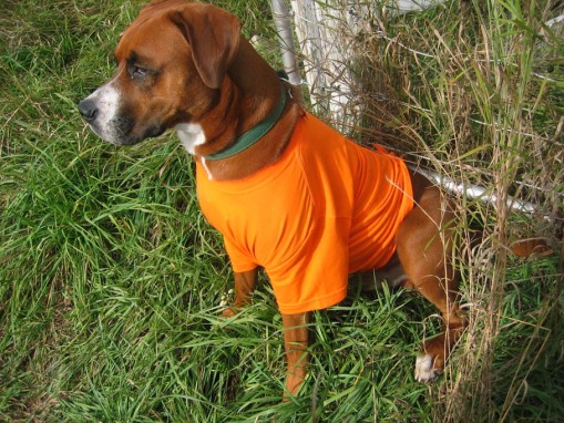 |
| Blaze orange - the colour that says "Don't shoot me" |
There were a hunters strategically positioned all the way out of the valley - it seems I had walked into a weekend event of the local hunting dog club.
Got to enjoy some great views of Mt Buller as I drove past 8 mile Gap and made a note to get back to do the West Ridge some time soon.
| Mt Buller |
Overall, it was an great trip. I was disappointed not to have reached Mt Eadley Stoney and the Bluff, but I figure they will still be there another day. I also learned a couple of important lessons about snow shoeing: it can be bloody hard going and can make a mockery of 'normal' track times.
Footnote re the found iPhone. I left the it to dry for a few days, then used a small brush to clear debris from the sockets. I then put in in a jar of rice for a few days to further dry it out, after which I charged it and, lo and behold, it worked! It wasn't password protected so I was about to peruse the contacts and text message to figure out that the phone belonged to someone called Erin. I found a contact named 'Home" and called them. Sure enough, it was the owner's father, in Sydney. Erin, it turns out, lives in Geelong. She was very pleased to take my call!
Footnote re the found iPhone. I left the it to dry for a few days, then used a small brush to clear debris from the sockets. I then put in in a jar of rice for a few days to further dry it out, after which I charged it and, lo and behold, it worked! It wasn't password protected so I was about to peruse the contacts and text message to figure out that the phone belonged to someone called Erin. I found a contact named 'Home" and called them. Sure enough, it was the owner's father, in Sydney. Erin, it turns out, lives in Geelong. She was very pleased to take my call!
Good to see you out and about and blogging again! This sounds like a pretty eventful trip! I don't know, but I never feel comfortable walking around where there's blokes with guns. No doubt they're responsible shooters, but it doesn't make me feel any easier.
ReplyDeleteMm... that footprint. Maybe it was a Yowie looking for his shoes? Which just so happens you've got?! Nice work with getting the phone back as well!
Thanks Greg and great point re the Yowie looking for his shoes!
DeleteA big ask, that walk at that time of year. I'm always a bit nervous when hunters are about. How did you feel about it?
ReplyDeleteIfoletta I felt a bit exposed with the hunters around. I really wanted something blaze orange to wear (could have worn my tent, I guess :) )
ReplyDeleteWell done on the phone, here hunting is a way of life and I have orange clothing and hats to match. It is when the shot is fired when you are half asleep in your tent that frightens the ... out of you. Your report brings back fond memories of the area. BTW how is that mid going? What pole set up do you use to support it? And I did wonder if you have camped above treeline in high winds in the mid?
ReplyDeleteHi Nielsen. I have only used the mid in Winter so far. For the centre pole I use two ski poles, joined with a strap. For Summer I am planning to use a 170cm bamboo staff. I have a foldup Easton pole, but the gauge (11mm) is too light and it bends when under pressure. 16mm would be better.
ReplyDeleteI have used the tent once in strong winds - on Mt Bogong. That night a corner tie out got ripped out! I have since reinforced all the tie outs with an extra piece of material. I have also added a noseeum skirt, which I can also use as storm flaps in the snow ie cover the skirt with snow to hold the tent down.
Overall, it has been sufficient for the snow, but I would prefer to have a 2-skin, floored tunnel tent for Winter and use the mid for rest of the time.
Andrew
Bro, is that the same hike we did 20 years ago?
ReplyDelete-James
James Dio you mean the Overland Track in Tasmania, the Routeburn or the hike near Melbourne where we pitched camp then had the day hiikers stroll past? (It was none of those?)
DeleteI think the general rule in snow is to double the time it would take in normal conditions, so that three day walk becomes a six day walk, not to mention the sun setting earlier and rising later in winter (although in August the days are starting to lengthen after the solstice) and the normal margin for error you might add. I did a three day walk on Bogong in mid June and we were hard pushed to cover 10k a day in snow. Not to matter. It's all a learning experience. Mind you, I've had my eye on that walk for a while, and doing it as a six day walk on snow shoes next year is not a bad idea...
ReplyDeleteJ.
JF Between this and another recent hike (blog in progress) I have found the multiplier to be closer to 3x. All the best for your next Bogong trip
DeleteNice little adventure mate, and good choice of reading material too!
ReplyDeleteCheers, Darren. I have read quite a few mountaineering books over the past year. Next step is to get some technical training..my goal is to climb Mt Cook within 3 years. Andrew
ReplyDeleteSubject: [trailsandtracks] Re: Trails and Tracks: The Bluff Southern Circuit - August 2012
Enjoyed the read Andrew. Thx. (off to put a jacket on - shivering after checking out your pics).
ReplyDeleteHi JaneLOL. Be sure to check back in Summer so you can read about my warm weather exploits - then you can reach for a chilled water. :)Andrew
ReplyDeleteSubject: [trailsandtracks] Re: Trails and Tracks: The Bluff Southern Circuit - August 2012
I add at least 25% to those guide book times in summer. They don't count any rest stops either. Getting an earlier start from a car camp takes off the time pressure and you can enjoy it more. You can relegate your old gear to this duty and justify any new gear then. Are there any campsites up near KB1? I've camped on the Bluff track near Mt Lovick in snow - might have been no harder way back.
ReplyDeleteHi Peter I cut the walk just short of the KBs, so couldn't tell you what camping options there are near KB1 - and the guidebook doesn't mention anything. I will return again next year to complete the full circuit. Cheers.
ReplyDeleteThere is a great campsite below King Billy 1. The track down is slightly to the SE of the main route through to Magdala and Howitt, where the walking track down from KB1 joins the road. You descend a hundred metres or so to a shelf below KB1. It's reasonably sheltered and there is water in a creek about 5 minutes further on. The creek is shown on the VMTC map.
ReplyDeletegood on you for handing in the phone
ReplyDelete